
True, there are no high and low tides here. But apart from that the Rhine-Neckar Metropolitan Region has almost everything to offer in terms of scenery: deep forests and wide valleys, sunny fields and colourful vineyards, steep gorges and soft sand dunes. Along the region’s boundaries, there are the Odenwald and Pfälzerwald low mountain ranges and the rolling hills of the Kraichgau and Bauland areas, which enclose the Rhine Rift Valley and the Neckartal valley. The opportunities for an “active” stay are unlimited here: hiking, walking, climbing, swimming, trekking, mountain biking, geocaching or cross-country skiing. But even if you simply want to enjoy yourself, you are guaranteed to get your money’s worth here where four winegrowing areas meet and where mountain huts, wineries and star-rated restaurants alike invite you to feast.
Palatinate Forest

Germany’s largest contiguous forest area and the North Vosges reserve on the French side of the border form the country’s only transnational Biosphere Reserve, to which even wolves and lynxes have made their return. The Palatinate Forest is a unique nature reserve. Numerous hiking trails invite you to explore it. A trail network of around 10,000 kilometres has something for everyone on offer—for experienced hikers as well as for families with young children with or without a pram. There are designated bouldering areas as well as mountain bike trails. And don’t worry—if all the exercise in the fresh air has made you really hungry, you’re sure to take refuge in one of the 80 mountain huts, some of which welcome you even in the most seemingly tucked away parts of the forest and have been deemed UNESCO Intangible Cultural Heritage sites since 2021.
Forest bathing in the Palatinate: Pack your hiking pants!
Modern paper-chasing in the forest near Bellheim: Treasure hunting with just a few tools and a phone
German Wine Route
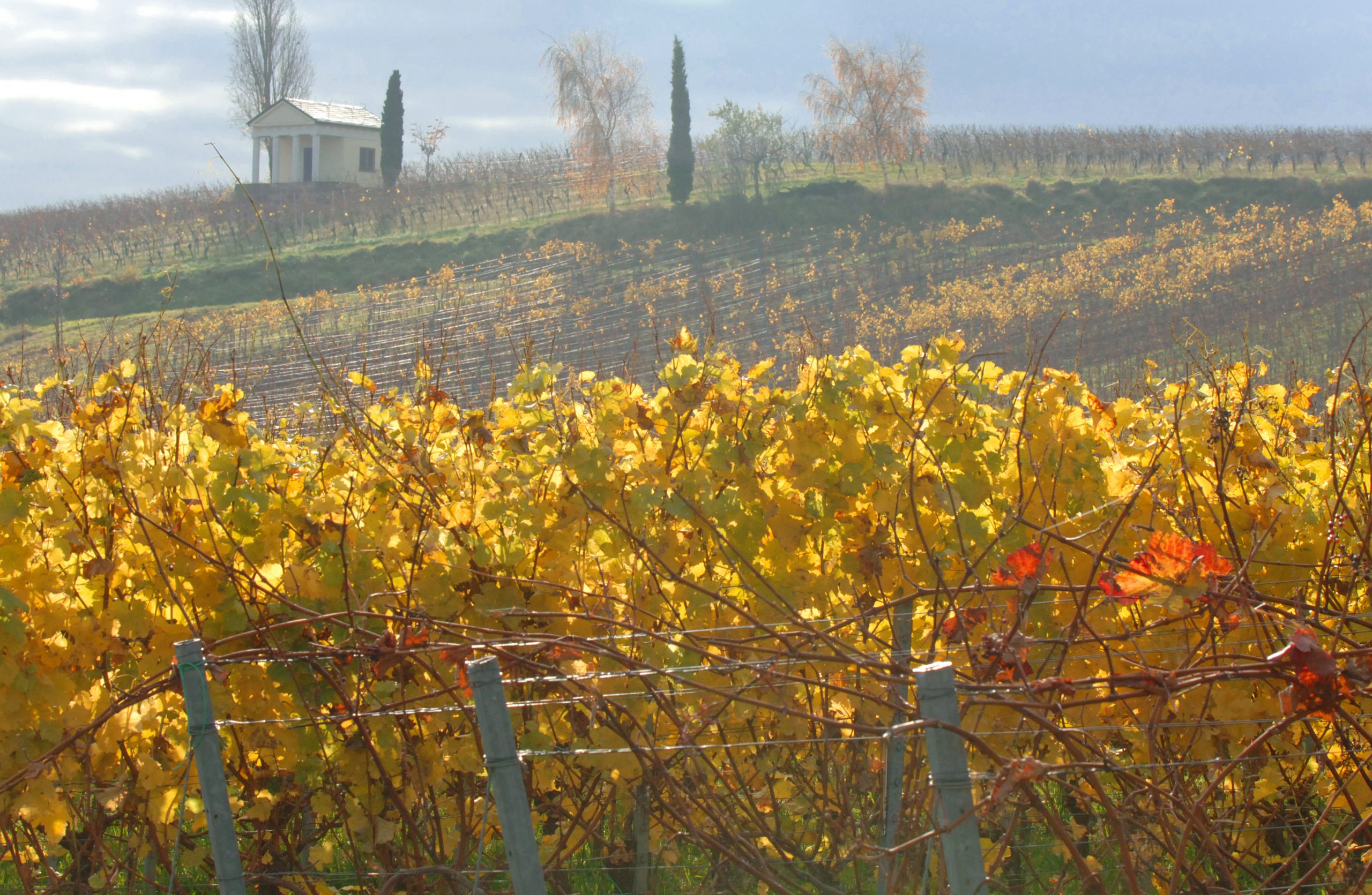
The German Wine Route catches the sun along the gentle hills of the Palatinate Forest gradually giving way to the plains here. This area offers ideal conditions for grapevines to thrive—but also for plants that are more typical of the Mediterranean climate. Figs, kiwis, lemons and pine trees thrive, and the early almond blossom heralds the arrival of spring in Gimmeldingen and beyond, every year anew. The German Wine Route is one of the oldest tourist roads in the country. It runs along the edge of the Haardt low mountain range—across slopes and hills and through numerous wine villages passing vineyards and almond trees. On the last Sunday of August each year, the road is closed to motorised traffic to accommodate 300,000 pedestrians, cyclists and inline skaters. If you don’t want to wait for that one day, you can explore the cycle path alongside the Wine Route, which is part of the ring route in the system of Regionalpark routes in the Rhine-Neckar Metropolitan Region. There is always a wine festival somewhere between March and October.
The Gartenakademie Rheinland-Pfalz botanical college: The Fruits of Change
The path of poems in Edenkoben: Strolling with poetry
The Rhine Rift Valley and the Rheinniederung lowlands along the river
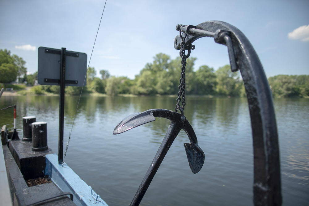
The Rhine has shaped the region in scenic, historic, economic and cultural terms. The Upper Rhine Plain unfolding to the left and right of its course is a place where opposites meet. The major towns of Mannheim and Ludwigshafen are located here, and population density there is just as high as the traffic density. This is mainly down to the straightening of the Rhine in the 19th century, which enabled the conduct of industry and intensive agriculture close to the river on the one hand and unique biotopes to emerge and to be increasingly renaturalised in the meanders of the original course of the river on the other. Forests with sand dunes make a natural habitat for numerous endangered animal and plant species. The Rheinniederung conservation area has comprised many wildlife refuges such as the Reißinsel island in Mannheim or the Ketscher Rheininsel island since 2005. Gravel and sand have been and are still being quarried in a number of places, which has resulted in the development of quarry lakes. The lowland meadows are thus part of the blue scenery of the Rhine-Neckar Metropolitan Region offering a wide range of opportunities to experience wildlife, water sports and camping. If you want to make full use of the area’s diversity, get in the saddle and follow the Rheinachse route along the EuroVelo 15 long-distance Rhine Cycle Route—and perhaps come across old Emma, a ferry that traverses an arm of the meandering original river course.
A ferry trip on the Altrheinfähre Emma near Mannheim: A decent talk with Emma
The Bienwald: Of forests, dunes and mussels
Bergstrasse road
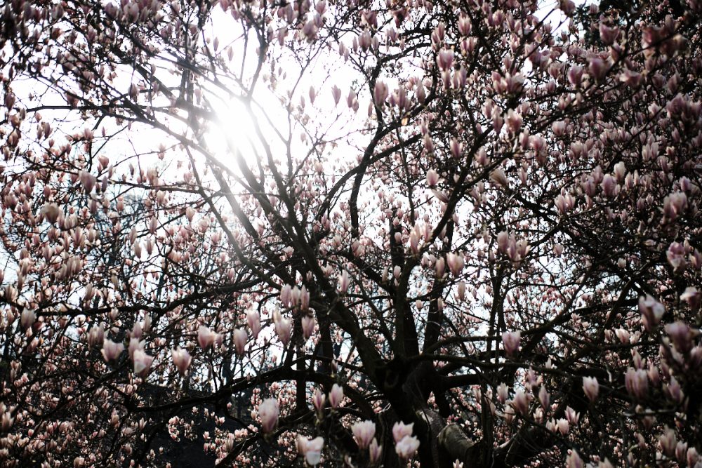
Just like the German Wine Route at the western side of the plains, the Bergstrasse road catches the sun along the slopes of the Odenwald on its eastern side. It stretches from Wiesloch to Darmstadt and is one of the sun terraces of the Rhine-Neckar Metropolitan Region. It is part of the UNESCO Geo-Naturepark Bergstrasse-Odenwald. Fertile loess soils make the landscape one of Germany’s richest fruit gardens with vineyards and orchards. Nowhere else in Germany does spring begin so early, which is why a hike along the Blütenweg—the blossom trail—is worthwhile even in March. If you prefer a more challenging hike, take the neighbouring Burgensteig long-distance trail along the numerous castles, which offers significantly more ascents—but also even greater views. Many gardens and parks along the Bergstrasse invite you to take a stroll. Come with us to the Fürstenlager landscape garden in Bensheim or the medicinal herb garden of Weinheim Castle:
The Fürstenlager landscape garden: Sauntering Just for Fun in the Summer Breeze
The Weinheim castles herb garden: The green pharmacy
Odenwald low mountain range and Neckartal valley
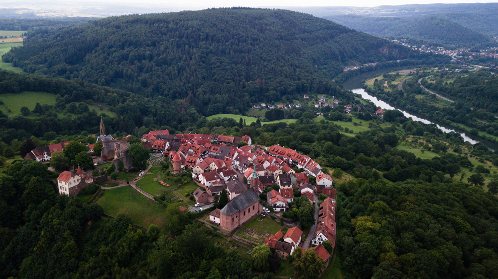
500 million years of changing geological history have left their mark on the Odenwald. Its landscape is accordingly diverse. There is the crystalline part, whose mountains and rigid clefts sit on granite rock. And there is the Bunter part with its plateaus and long, striking valley incisions. The Bunter formations of the steep slopes along the Neckar river are particularly impressive. Over thousands of years, the river has carved narrow loops through the rock here. Castles, ruins and idyllic towns line its course. To discover them, you can hike along the Neckarsteig, a long-distance trail from Heidelberg to Bad Wimpfen, or leisurely glide past them on the river. On the other side of the Neckar is the gentle, but no less exciting, neighbour of the mountain range: the Little Odenwald.
Paying a visit to Dilsberg mountain near Neckargemünd: Crossover, Castle and Chocolate
Gliding along the Neckar on one of the Weisse Flotte ships: Culture cruise
Kraichgau

The Kraichgau is nicknamed the land of a thousand hills. The landscape here flows in gentle waves between the Neckar and Enz rivers and the Rhine Rift Valley. The soil is fertile, which is why the Kraichgau has been populated and cultivated since antiquity. The region is considered one of Germany’s granaries, but fruit and wine are grown here as well. Castles and palaces, half-timbered villages and local history museums, traditional festivals and local customs bear witness to a long, varied history. The Kraichgau is one of the oldest cultural regions in Europe. However, the museum of technology and the Klima Arena centre on climate change in Sinsheim take a look into the future instead.
A journey into the past in the monastery church in Lobenfeld: The Chronicler
The Technik Museum in Sinsheim: Airborne and infernal machines
Bauland

The Bauland region is a wide hilly landscape alternating between woods and fields, offering wide-open views time and again. Less Mediterranean than other landscapes in the Metropolitan Region and much less populated, the Bauland is colloquially known as the ‘Baden Siberia’. This byname was originally used in a derogatory way, but the humorous locals have long used the term themselves. Agriculture has always played an important role in the Bauland, and the region is known as the origins of the Grünkern, the ‘green grain’. To the east, towards the Taubertal valley, there is the Madonnenländchen—literally the ‘Madonna region’— with numerous wayside shrines that depict the Virgin Mary and tell stories from another era. Visitors can travel even further into the past tracing the Upper Germanic-Rhaetian Limes fortification, which runs through the east of the Metropolitan Region via Walldürn and Osterburken, and has been a UNESCO World Cultural Heritage Site since 2005.
Following a speciality: Everything for the green grain
The Madonnenländchen: Witnesses made of stone
The different landscapes of the region are summarised as “Die Prächtigen 10“ (the magnificent 10) and their further development is promoted in various committees and working groups of the Metropolitan Region. Click here to read more about the magnificent 10: Rhine-Neckar Regionalpark
Do you want to explore the different landscapes on a holiday in the region? The staff at the Tourist Information is happy to help you. Click here for a map of Tourist Information offices.